

Dawn at Mount Washington Hotel and the Presidential Range

Start of the Crawford Path, the oldest maintained trail in the United States

This little guy found some yummy garbage, so I named him Oscar

Still plenty of snow on the Crawford Path below treeline

Breaking into the scrub below Mount Pierce

Webster Cliff / Crawford Path Trail Junction, the Crawford Path now becomes part of the Appalachian Trail

Mount Pierce Summit Area

Early morning from Mount Pierce

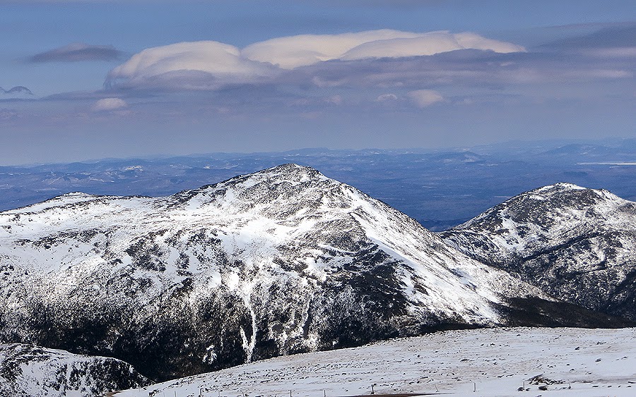
Clouds layers above the Camel and Boott Spur
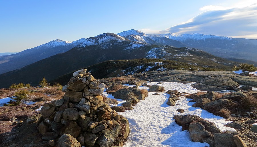
Presidential Range as seen from Mount Pierce

Along the Crawford Path

Heading to Mount Eisenhower, the trail goes in and out of the scrub

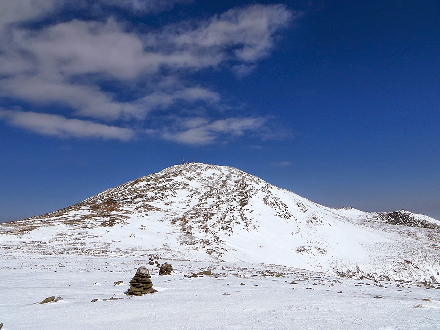
Looking back at Mount Pierce
Mount Carrigain and the Vose Spur

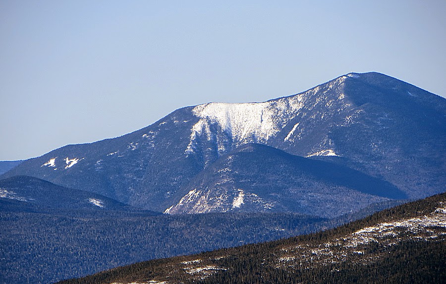
Mount Jackson and Webster with Mount Carrigain and the Hancocks behind it

North Twin Mountain and its slide

Eisenhower Loop Junction

Heading up the Eisenhower Loop Trail

Mount Eisenhower Summit Cairn

Descending the Eisenhower Loop Trail

Heading north to hook onto the Crawford Path again

Edmands Path / Crawford Path Trail Junction

Looking back at the 'Pleasant Dome' - Mount Eisenhower

Mount Carrigain as see from the Crawford Path
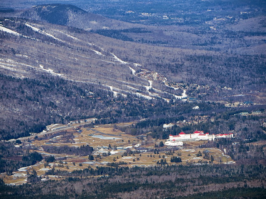
Mount Washington Hotel

Mother Nature groomed this section of trail

Lil' Monroe and Monroe with Mount Washington

Crawford Path near the 'Franklin Flats'

Heading towards Mount Franklin

Thawing out!

Mount Franklin Summit

Looking back south from Mount Franklin

Mount Monroe rising high above the Oakes Gulf

Mount Monroe, below this is the Crawford Path which just disappears into steep snow field

Mount Monroe and Washington

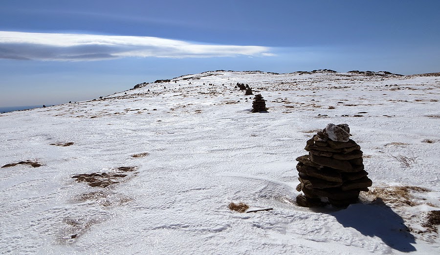
A lonely cairn along the Crawford Path
This used to be the Cross Cairn (it's falling apart) on the Monroe Loop Trail

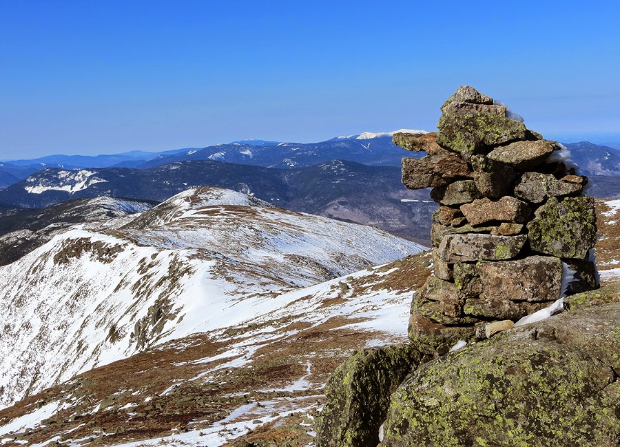
Southern Presidential Range as seen from Mount Monroe's Summit

Lakes of the Clouds Hut, lots of snow, notice the hiker roaming around the roof!

Mount Washington

Closed until June!

One sad looking dog house!

Dungeon with a view!

Frozen Solid Lakes of the Clouds

Camel Trail

Mount Monroe

Cool looking saucer cloud floating above the Presidential Range

OddCool looking cairn along the Camel Trail

Cairns marking the way along the Camel Trail

Bright sun shinning and melting the snow
Davis Path

The Big cairn on the Davis Path

Boott Spur

Perfect day high above the trees!

Looking south, Black Mountain ski area can be see to the far right

Wildcat Ski Area

Mount Washington

Skiers heading up the steep snow fields below Mount Washington

Mount Monroe and Mount Eisenhower

Davis Path

Skiers along Lion Head Trail heading to the 'LIP'
Heading north to Mount Washington

Skiers slowly making their way up

A line of skiers heading to the eastern snow fields

Huntington Ravine makes for a great backdrop as it dwarfs the tiny skiers marching to the summit

The Davis Path Plateau

Monroe

Lakes of the Clouds Hut getting busy

The Twin Range with the Franconia Ridge behind it

Summit tower and buildings popping up

Castle in the Clouds

Northern Presidential Range

Old telephone wire?? Mount Willey is in view here

Weather Observatory

Mount Washington 6,288

Nelson Crag Trail
Mount Adams and Madison

Cog Tracks

Looking back up the semi snow covered tracks

Skiers making their way up

Some places the tracks are exposed

Other places they remain burried

Dogs on the Cog Railway!

Semi steep drop off to the right, easy to walk up but a little harder to descend, I stayed to the left

Jacob's Ladder makes its first appearence

Jacob's Ladder

Hiking along the cog is a nice alternative to the trail this time of year

Jacob's Ladder marker

Skiers heading up to ski down the tracks, or Great Gulf, or down to Pinkham

Nice wide open 'road' along the tracks

Big clouds came rolling in around noonish

Tracks now above the snow for good

Looking back up to Washington's summit

Waumbek Water Tank

Final stretch of tracks above Marshfield Station

Making my way off the mountain

Brenton Woods

Looking back up one last time

Choo Choo!

The Cog Railroad

Parking lot is full!

Historical Marker

Base Station Road

Welcome to Mount Washington

Clinton Road, it was bare in spots, light coverage in others, and...

Deep snow as the road approaches the Crawford Path and Route 302

Route 302 at the Highland Center

Jeep at the Highland Center

Map of my route is in red, the green is the Edmands Path, click here for more details of the hike
No comments:
Post a Comment