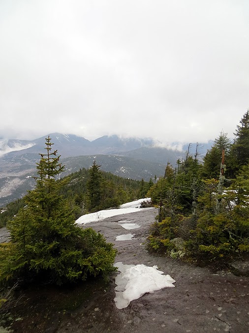
Heading up a drainage on the Zander Scott Trail
Lower Great Range
Chapel Pond and Round Mountain
Scarred walls of Round Mountain above Route 73
Armstrong, Upper and Lower WolfJaw
Zander Scott Trail just above the Giant Washbowl
Roaring Brook / Zander Scott Trail Junction at the Washbowl
A couple of days ago you could snowshoe across the frozen pond, now you have to take the old foot bridge
Giant Washbowl
Outlet of the Giant Washbowl
Nubble / Zander Scott Trail Junction
Ice flow stretch on the Zander Scott Trail below the exposed ridge section
Giant Washbowl, with Round and Noonmark Mountain and the Great Range
Washbowl and Noonmark
Left to right: Gothics, Armstrong, Upper and Lower WolfJaw
Gothics through Rooster Comb
Pyramid and Gothics
Undercast to the south
Round Mountain
Dix Range in the clouds
Looking east toward a southern sub summit of Rocky Peak Ridge
Green Mountains of Vermont
Round and Noonmark Mountains from the ridge
Zander Scott Trail, mix of snow, ice, and bare slab on the ridge
Iced over Zander Scott Trail near the 'BUMP'
Zander Scott / East Trail Junction
Approaching the summit of Giant
Giant Mountain Summit
Interesting marker on the summit
Summit survey marker
Giant Mountain #2W
Frozen Ice flow below the summit of Giant Mountain
Rocky Peak Ridge from the East Trail
Heading up the East Trail to RPR
Rocky Peak Ridge Summit area
RPR Summit area
Rocky Peak Ridge #3W
Giant / Rocky Peak Ridge Col
Large blankets of ice heading back up to Giant Mountain, easier to ascend then descending
Back over the BUMP!
Low level clouds just hanging around the Hammond Pond Forest area
Twin Pond
Looking toward the eastern edge of the Dix Range Wilderness
Hunters Pass
The Lower Great Range
Ausable Club
Slides on the northeast face of Dix Mountain
Undercast floating in from Vermont
Dix Range
Sawteeth, Pyramid, and Gothics
Pyramid and Gothics
Vermont
More ice just below the exposed ridge
Here fishy, fishy, fishy!
Zander Scott Trail Register


No comments:
Post a Comment