

Pinkham Notch Visitor Center
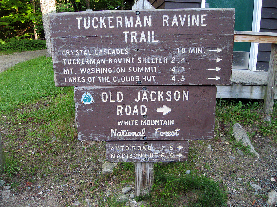
Tuckerman Ravine / Old Jackson Trailhead

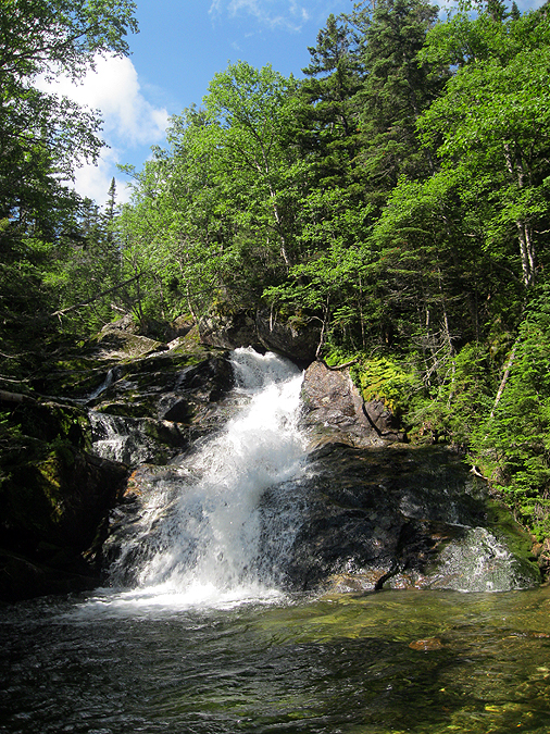
Crystal Cascade

Tuckerman Ravine Trail

Huntington Ravine Trail

Cutler River

Raymond Path / Huntington Ravine Trail Junction

Huntington Ravine Trail, the floor of the ravine. Notice the new growth pine trees lining the trail!

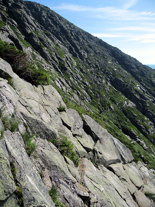
Ravine headwall from the floor of the ravine

Albert Down First Aid Cache

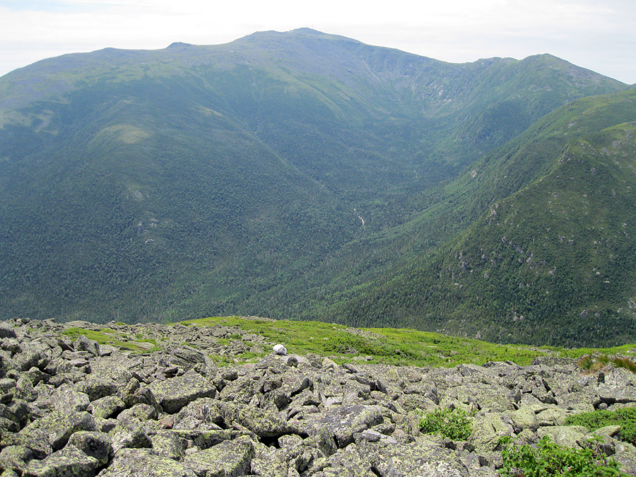
Huntington Ravine, The Fan is the boulder field, above it is Pinnacle and Central Gully

The Fan, with Pinnacle and Central Gully

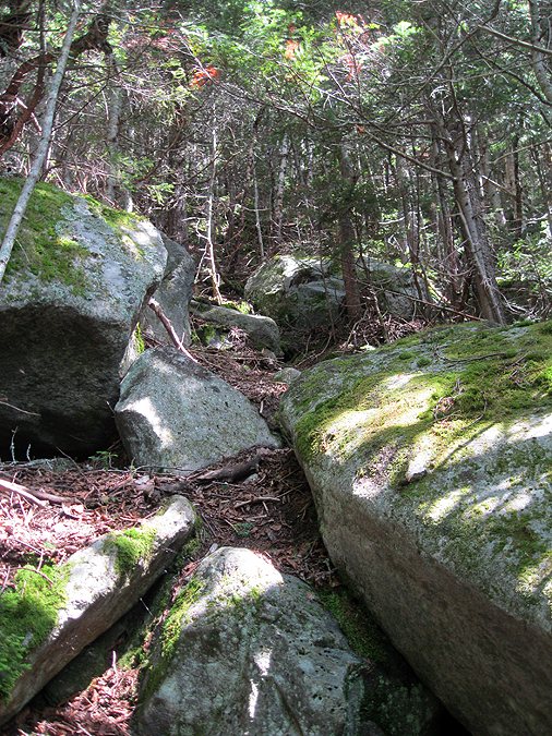
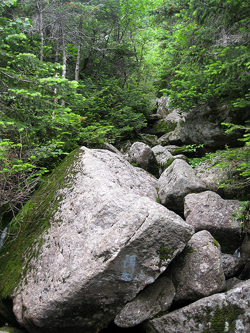
Huntington Ravine Trail, it winds through car and house sized boulders in the woods below the fan.

Huntington Ravine Trail, over and under boulders

The Fan, the trail enters the left side and goes diagonally across it

Hiking across the Fan

Pinnacle Gully

Huntington Ravine Trail after the fan heading to the first scramble, notice how overgrown this section is.

Pinnacle Gully

Black Eyed Susans (I think) just below first scramble

Bottom of first scramble. There's a yellow blaze and a white arrow in the pic.

First Scramble, notice the white arrow pictured up and to the left

First Scramble

First Scramble, probably the trickiest section, you have to climb up then across some slab

Looking down the first scramble, notice the wet part, this usually is not there, it was slimy and slick

Huntington Ravine

Top of first scramble

Looking down the first scramble

Slick section on the first scramble

Slick section

Second Scramble, still steep but can be walked up with minimal hand holds

Second Scramble

Looking down the second scramble

Wildcat and Carter Range

Wildcat Ski area

'Diagonal Scramble' trail goes across this crack

'Diagonal Scramble' notice the double arrow
'Diagonal Scramble'

Huntington Ravine Trail

Huntington Ravine Trail

Huntington Ravine Trail, looking down the chimney section. It's a fifteen foot climb but lots of handholds

Huntington Ravine Trail

Top of Ravine

Alpine Garden / Huntington Ravine Trail Junction

Spiderman!

Alpine Garden

Top of the Ravine

Top of Huntington Ravine


Nelson Crag Trail, with Wildcat Ski area across the Pinkham Notch
Alpine Garden, one of the finest sections of alpine hiking, lots of flowers blooming through there in June
Nelson Crag Trail, travels over a jumbled odd sized rocks and boulders on it's way to Washington over the 'Ball Crag'
Nelson Crag Trail, the Auto Road mile seven (I think) is pictured to the left
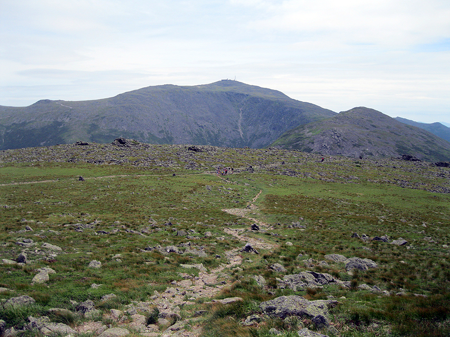
Nelson Crag Trail, up to Mount Washington's summit
Mount Washington Observatory and the Cog Railway tracks
Nelson Crag Trail, looking at Ball Crag. This picture is taken at the Auto Road
Cog Railroad, with Mount Clay and Jefferson
Lizzie Bourne Memorial, she was the first documented case of someone dying on the mountain. She was a teenager, they ran into cold weather and bad visibility and could not find the summit which was just a couple hundred feet away. The group laid down for the night in the elements but she did not make it and succumbed to hypothermia.
Mount Washington summit and the weather observation tower
Northern Presidential Range, Jefferson, Adams, Madison
Observation deck and weather tower
North!
The Cog chugging its way up the tracks with Mount Clay
The Cog. The first train up for the day is always the coal train. It's not run as much for efficiency reasons
The Cog with Jefferson, Adams, and Monroe
The Cog and Mount Jefferson
The Cog and Mount Jefferson
The Cog and the Mount Washington summit flats
The Cog and Mount Jefferson
The Cog and Mount Jefferson and Adams
The Cog slowly making its way to the summit
The Cog and the Northern Presidential Range
The Cog and Mount Adams
The Cog
The Cog and a big plume of smoke
Along the Cog Railway Tracks

Great Gulf Trail and wilderness boundary

No camping allowed

The top of the Great Gulf Trail

The Great Gulf Trail

Spaulding Lake

The Great Gulf Trail

The Great Gulf Trail, as landslide came in from the left and whipped out the old trail which looks the same as the new one because it's still loose boulders!

The Great Gulf Trail

Great Gulf Wilderness

The Great Gulf Trail turning into a river

The Great Gulf Trail goes through a water flow which makes for some interesting maneuvering from one side to the other

The Great Gulf Trail

The Great Gulf Trail

The Great Gulf Trail

Waterfalls in the Great Gulf Trail

The Great Gulf Trail. The Trail is a waterfall by this point

The Great Gulf Trail

The Great Gulf Trail

The Great Gulf Trail

Flooded Great Gulf Trail. This was always wet but no it's a moving stream. There's not much that can be done to fix this.

Spaulding Lake

Spaulding Lake

The Great Gulf Trail, it's dry in a few spots!

Mount Adams from the Great Gulf Trail
Weetamoo Cascade and Falls

Brook Crossing on the Great Gulf Trail. Most of them are shallow but not rock hop-able. During a storm this little crossing would actually become dangerous

Flooded Great Gulf Trail. Another section that is a moving stream now.

Brook crossing on the Great Gulf Trail. This one was rock hop-able

Weetamoo Cascade and Falls
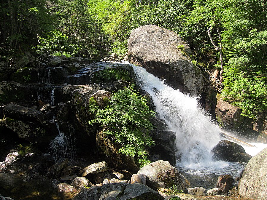
Weetamoo Cascade and Falls

Weetamoo Cascade and Falls

Weetamoo Cascade and Falls

Old site of the Great Gulf Shelter and Lean-to

Flooded Great Gulf Trail. Just between the old shelter site and the Six Husbands Trail Junction. This is a complete mess of shallow water with nasty mud underneath. Bog bridges would fix this in an instant.

West Branch crossing on the Six Husbands Trail

Mike helping a hiker across the West Branch

West Branch

Six Husbands Trail

Six Husbands / Buttress Trail Junction

Buttress Trail crossing. It's rock hop-able

Buttress Trail talus field. the Buttress trail turns and heads across this field. If you don't turn and head across and decided to go up into the woods you will find...

This, the start of the Abandoned Adams Slide Trail

Old faded pieces of paint on a rock blazing the way

Adams Slide Trail. It's overgrown but can be followed with care.
Adams Slide Trail, heads over small boulders in the woods.

Adams Slide Trail, It's very steep but all enclosed so it's not intimidating.

Adams Slide Trail. this section was fairly open and easy to follow

Adams Slide Trail

Adams Slide Trail. Looking down the trail it's steep and narrow

Adams Slide Trail. As you can see moss has overtaken the rocks. Dirt and debris has covered most of the slide which is buried beneath feet of this stuff.

Adams Slide Trail. Gets a little 'scratchy' notice the top of the rocks that is the slide

Blaze to the right. There are more blazes found here than any other trail in the wilderness area!

Blaze and the slide. More of the slide is above the dirt and debris through this section

Cross Blaze. I always like this blaze. It must be close to 75 to 100 years old

Adams Slide Trail. Slide visible in this pic.

Adams Slide Trail

Adams Slide Trail

Adams Slide Trail

Adams Slide Trail. Looking down it, it gets a little tougher to follow at times

Adams Slide Trail. This section of fifty feet or so had some trickling water on it. I stayed to the right into the thick woods to not damage it.

Another blaze, an arrow blaze. Interesting

Adams Slide Trail. Notice the faint paint on the rock.

Faded blaze

Trail gets 'scratchy' to extremely thick right before the alpine zone

Adams Slide Trail

Adams Slide Trail, still steep, not as defined

Last section before you pop up in the middle of nowhere

Looking down at where you pop out. The Trail comes up from the middle - bottom of this photo

Knee of Mount Jefferson

Ladder section of the Six Husband Trail is through the rocks in this pic

Jefferson Ravine and Mount Jefferson

Adams Slide Trail. The trail once breaking into the scrub heads right then turns left up this rock were you are then greeted with...

the following! Notice the faint gaps between the branches, that's the trail.

A very old blaze can be found if you push the branches back when you stumbled over a rock you can't see while heading through the thick scrub.

Jefferson Ravine

Adams Slide Trail, again, notice the faint gaps between scrub. that's the trail

Great Gulf. This was a decent sized cairn three years ago, topped with white quartz. now it's been whipped out by weather or a ranger

Blaze under the scrub

Adams Slide Trail heads up to the left of the rock on the top right. Another blaze used to be where those small rocks are on the rock ledge,

Adams Slide Trail, one of the few white quartz cains left.

Adams Slide Trail

Adams Slide Trail heads up the boulder field on the eastern shoulder of Mont Adams

Adams Slide Trail, notice the small white quartz rock. Once again the cairns are smaller than before either from being whipped out from snow or a ranger

Adams Slide Trail cairn

Adams Slide Trail

Adams Slide Trail
The Great Gulf as seen from the Adams Slide Trail

Adams Slide Trail cairn

Mount Jefferson

Jefferson ravine

Adams Slide Trail cairn

Adams Slide Trail, last blaze I saw, notice the red paint on the rock. Pretty cool stuff!

Adams Slide Trail

Adams Slide Trail. Once again these cairns where at least a foot high to two feet three years ago

Adams Slide Trail

Adams Slide Trail

Wildcat Ridge off in the distance

Heading up to the summit

High above treeline

Approaching the Star Lake Trail

Adams Slide Trail

On the Star Lake Trail, looking down where I just came up

Star Lake Trail

Where the Adams Slide Trail goes, there is a small cairn in the pic which is was taken from the Star Lake Trail. This is the first cairn for the Adams Slide Trail. It usually is not there for obvious reasons. To keep people from exploring. Probably will be taken down by a ranger soon

Adams Slide Trail route (estimate), notice the talus field at the bottom right, that is wear the Buttress Trail takes a right and heads across

Mount Madison and Star Lake

Mount Adams Summit

Thunderstorm Junction

Gulfside Trail

Gulfside Trail

Gulfside Trail

Gulfside Trail

Edmands Col

Mount Adams

Gulfside Trail

Mount Adams

Mount Jefferson's Summit

Mount Clay, Washington, and Monroe

Jefferson Loop Trail
Jefferson Loop Trail

Monticello Lawn

Mount Adams rising above Monticello Lawn

Gulfside Trail

Gulfside Trail

Sphinx Col

Entering the Great Gulf Wilderness, again!

Sphinx Trail

Sphinx Trail

Sphinx Trail

Sphinx Trail

Sphinx Trail

Sphinx Trail

Sphinx Trail
Sphinx Trail, notice the blue blaze. One of only two left on the trail. No longer to be blazed because it's a Wilderness area.

Sphinx Trail

Just below where I bashed my finger!

Sphinx Trail landslide from Hurricane Irene

Sphinx Trail

Sphinx Trail / Great Gulf Jucntion

The West Branch

Six Husbands / Great Gulf Junction

Great Gulf Trail

Great Gulf Trail

Clam Rock

Madison Gulf Trail Junction

Madison Gulf Trail

Madison Gulf Trail

Old Jackson Road

Old Jackson Road

Old Jackson Road

Pinkham Notch Visitor Center Parking Lot
No comments:
Post a Comment